Neptune Monograph – The original top secret plans for the Normandy D-Day Invasion

NeptuneMonograph-5

NOTE to COXSWAIN or NAVIGATOR - Building landmarks, especially near the beach, may be destroyed before any craft land. Terrain features, therefore, are much more reliable for visual navigation from panoramic shoreline sketch above. green solid and broken lines with letter at each end on chart above refer to Beach Gradients on reverse side of this sheet. Also on reverse side are Sunlight and Moonlight Table, data on Inshore currents and Tidal Stages

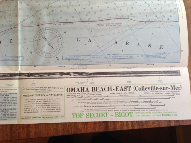
NOTE to COXSWAIN or NAVIGATOR – Building landmarks, especially near the beach, may be destroyed before any craft land. Terrain features, therefore, are much more reliable for visual navigation from panoramic shoreline sketch above. green solid and broken lines with letter at each end on chart above refer to Beach Gradients on reverse side of this sheet. Also on reverse side are Sunlight and Moonlight Table, data on Inshore currents and Tidal Stages

Bookmark the permalink.

Leave a Reply

Your email address will not be published. Required fields are marked *


*